
Exploring Our Warming World in 5K Ultra HD
Overview
NASA is exploring our warming world in 5K Ultra HD resolution with more than 16 million pixels (horizontal grid cells) in our Goddard Earth Observing System (GEOS) atmospheric model. Using the world-class Modern-Era Retrospective analysis for Research and Applications, version 2 (MERRA-2) from 1980 to present as a baseline for our exploration, we are using the GEOS model to refine the fidelity of this analysis down to 6-kilometer (km) grid cells covering our entire planet from the surface to the top of the mesosphere more than 50 miles above. The resulting analysis becomes the finest-resolution look at the details of our changing planet.
Project Details
The Global Modeling and Assimilation Office (GMAO) uses GEOS in pathfinding missions to improve the predictability of Earth's weather and climate on weekly to seasonal and decadal timescales. These pioneering simulations provide a unique tool for exploring the impacts of increased resolution and improved representation of physical processes within the GEOS model. Increases in complexity are not limited to dynamical/physical processes and resolution alone; they include improvements in the representation of atmospheric chemistry and constituents such as aerosols and greenhouse gases.
Results and Impact
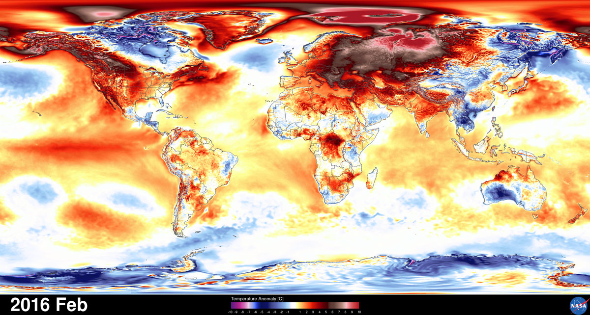
To complement the 36-year, 50-km global MERRA-2 atmospheric reanalysis, a 12-km global downscaled product based on MERRA-2 and GEOS has been produced from 2000-2015. Beginning in early 2016, this analysis has been refined to 6-km global resolution, providing the finest details of impacts including the major El Niño of 2015-2016 and the record-breaking global warming of 2016.
- February 2016 saw the largest temperature anomaly ever recorded for the globe at 0.84 °C warmer than the 1980-2010 climatology.
- In May 2016 carbon dioxide levels reached a global record high of 404 parts per million (PPM) as concentrations peaked across the Northern Hemisphere in excess of 410 PPM.
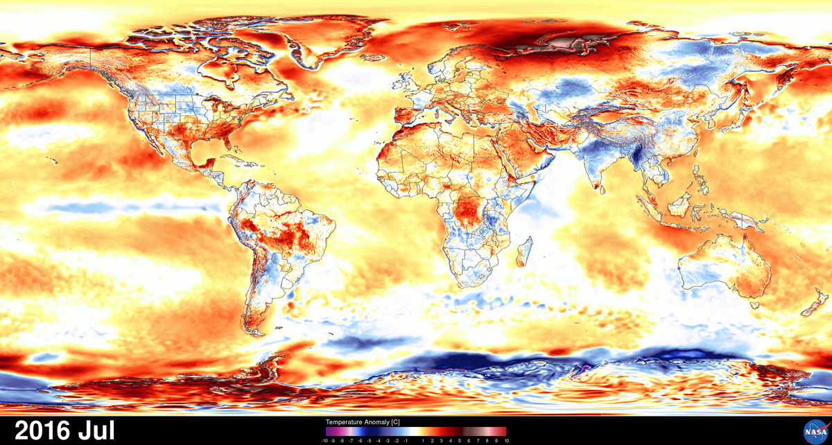
- Despite a cooling in the eastern equatorial Pacific Ocean, July 2016 was not only the warmest July ever at nearly 0.5 °C warmer than the 1980-2010 climatology, but the hottest month on record for the globe.
The GEOS model, with more than 16 million pixels displayed in stunning detail on the hyperwall at NASA's Goddard Space Flight Center, reveals the complexity of carbon dioxide as it is emitted into our atmosphere and transported around the globe, the worldwide dispersion of tiny particles from fossil fuel emissions and biomass burning, plumes of ash and sulfate streaming from volcanoes around the world, and a detailed picture of record warmth across our planet.
Why HPC Matters
High-end computing (HEC) at NASA, specifically the NASA Center for Climate Simulation (NCCS), provides an essential resource for preparing our modeling systems for emerging HEC systems and exploring new science developments. While current GEOS configurations require thousands of computational cores, systems in the 3- to 5-year range will require scalability to hundreds of thousands of cores with simulations by 2025 requiring scalability beyond one million cores. Exposing additional parallelism within GEOS becomes essential for reaching these scalability targets. Partnerships with the NCCS support our exploration of traditional hybrid parallelism approaches within GEOS today, and prepare our models for future HEC platforms by exposing new depths of parallelism within our application components.
William Putman, NASA Goddard Space Flight Centerwilliam.m.putman@nasa.gov