
Our Planet – A Virtual Telescope on the World's Oceans and Sea Ice
Using NASA high-performance computing resources and modeling tools, scientists have produced a time-evolving global simulation of Earth's liquid and frozen ocean system with approximately 1-kilometer horizontal spacing and 90 vertical levels—providing the oceanic equivalent of a telescope that can reveal the state of the entire ocean/sea-ice system in unprecedented detail. This simulation was carried out using the Massachusetts Institute of Technology general circulation model (MITgcm) as part of the Estimating the Circulation and Climate of the Ocean (ECCO) project. The ECCO team uses satellite measurements of relative sea-level change, gravity, temperature, surface wind stress, and salinity, along with in-situ and airborne data, to constrain ocean and sea ice configurations of the MITgcm. The ECCO simulations fill the gaps in observational coverage to produce self-consistent descriptions of the time-evolving ocean and sea-ice state. This work also provides a new tool for examining many scientific questions, such as: how the ocean takes up and releases heat and atmospheric gases; how ecosystems work in a turbulent fluid environment; how oceans interact with sea ice and ice sheets; and the degree to which small-scale ocean processes play a role in regulating the large-scale ocean and climate state.
This simulation is the highest resolution global-ocean configuration ever achieved with MITgcm. We are very excited about what we are already learning from these global ocean maps and what they will contribute to climate science.
Chris Hill, principal research engineer, MIT
Quick Facts
- The highest resolution MITgcm/ECCO simulation of Earth's liquid and frozen ocean system was produced on a grid with approximately 1-kilometer horizontal spacing and 90 vertical levels—an unprecedented achievement.
- This simulation was run across up to 70,000 cores on the Pleiades supercomputer at the NASA Advanced Supercomputing (NAS) facility at Ames Research Center.
- Researchers can navigate through multiple layers of the simulation in order to examine scalar and vector fields at various ocean depths.
- The ECCO project uses observational data from NASA satellites and ocean-navigating autonomous sensors and from traditional shipborne and mooring data to provide constraints for ocean and sea ice MITgcm configurations.
- The NAS-ECCO collaborations have resulted in a new tool that enables massive datasets to be efficiently generated for monitoring ocean and sea-ice changes.
Key Image
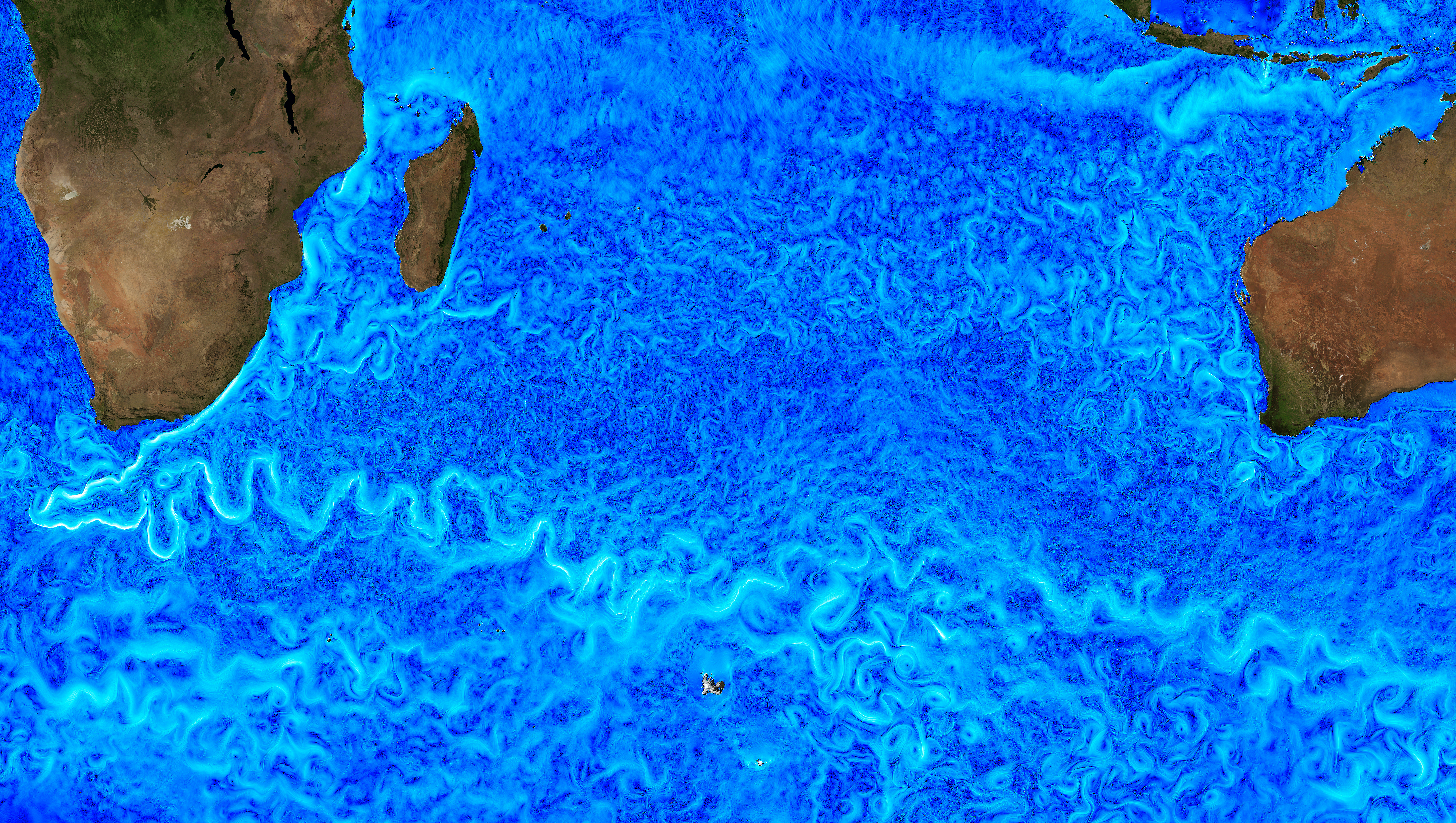
Image Caption
Snapshot of surface current speed in the Antarctic Circumpolar Current region, south of the Indian Ocean, in a global ocean simulation with 1-kilometer horizontal grid spacing. The ocean is teeming with cyclonic and anticyclonic eddies, which are visible in the image. Like their atmospheric counterparts (high-pressure and low-pressure systems), but much smaller in size and larger in number, these eddying flows play a key role in the transport of properties in the ocean. Christopher Henze, NASA/AmesDownload High-Res Image (28MB)
Contacts
Chris Hill, Massachusetts Institute of Technologycnh@mit.edu