
Re-creating Earth's Oceans Inside a Supercomputer
With the successful landing of NASA's Mars Curiosity rover last fall, and the recent planetary discoveries by the Kepler and Voyager spacecraft, people around the world are looking to space for exciting new information about the formation and scope of our galaxy. Yet NASA scientists are still learning new things about our own planet, and are using cutting-edge computer models run on the space agency's most powerful supercomputer to understand more about how Earth's ocean, sea-ice, and atmospheric systems interact and evolve over time, and what this might mean for the future of our planet.
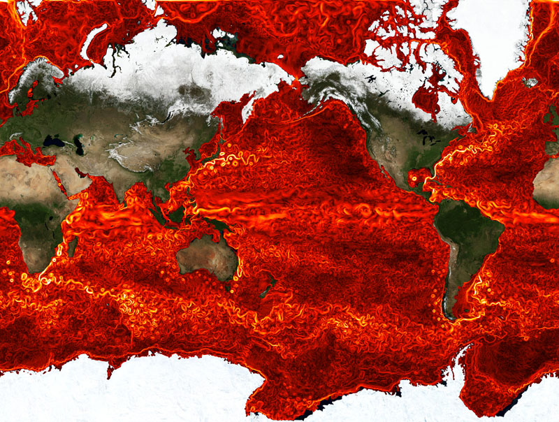
For more than ten years, the consortium for Estimating the Circulation and Climate of the Ocean (ECCO), a joint venture led by the Massachusetts Institute of Technology (MIT) and NASA's Jet Propulsion Laboratory (JPL) in Pasadena, Calif., has been developing advanced computational tools to study ocean currents and their interactions with Earth's atmosphere, sea ice, and marine terminating glaciers. The objective is to help monitor and understand the ocean's role in climate variability and changes, as well as to improve the representation of ocean-climate interactions in Earth system models.
Monitoring Oceans on a Global Scale
To further this goal, the ECCO project team uses the MIT general circulation model (MITgcm), a numerical model designed to study ocean, atmosphere, and sea ice circulation. The MITgcm is combined with observational data from NASA satellites and in-situ ocean probes measuring sea level, temperature, salinity, and momentum, as well as sea-ice concentration, motion, and thickness. This model-data combination requires the solution of a huge, non-linear, estimation problem, which is carried out on the Pleiades supercomputer at the NASA Advanced Supercomputing (NAS) facility at NASA Ames Research Center, Moffett Field, Calif. The result of this estimation is a realistic description of how ocean circulation, temperature, salinity, sea level, and sea-ice interact on a global scale.
"What we're trying to do is to get a global, full-depth, time-evolving description of ocean circulation that is, at the same time, consistent with the model equations as well as with all the available observations," said Dimitris Menemenlis, research scientist at NASA JPL and a leading member the ECCO project. "The estimation problems that are solved by the ECCO team are among the largest computations of their kind, and are possible because of the computing speed and power of the Pleiades supercomputer at NAS."
We expect a breakthrough in our ability to monitor, understand, and predict the time-evolving term balances within and between different components of the Earth system, and to be able to determine causal relationships between ocean circulation changes and accelerated ice sheet flow.
These computations involve billions of observations and control parameters, and trillions of predictive model variables–numbers that will only rise as the resolution of ocean models increases and new data is collected–making the role of supercomputers even more vital to the process of creating, storing, and analyzing global ocean circulation. For this reason, ECCO scientists have been working closely with NAS staff to optimize the MITgcm code and the ECCO estimation infrastructure to work more efficiently on Pleiades.
New Project Aims for Breakthrough Findings
A recently initiated project called ECCO-IcES (Ocean-Ice interactions in Earth System models) aims to improve the representation of ocean, sea ice, and ice sheets in climate models. ECCO-IcES is a cross-disciplinary effort that will combine the model and estimation infrastructure developed under ECCO with the Ice Sheet System Model (ISSM) developed jointly by researchers at NASA JPL and at the University of California, Irvine, and the Goddard Earth Observing System Model, Version 5 (GEOS-5). Scientists will use this trio of modeling codes to study the origin and evolution of water masses near the polar ice sheets, reduce uncertainties in sea level projections, and improve the predictive skill of climate models.
Menemenlis estimates that ECCO-IcES will require more than 50 million processor hours annually on Pleiades, doubling to 100 million hours per year in 2015. Long-term data storage requirements are estimated to reach about 800 terabytes.
"Both the ECCO and ISSM projects have now reached a level of maturity where it makes sense to integrate them with each other and with the GEOS-5 earth system modeling framework," said Menemenlis. "We expect a breakthrough in our ability to monitor, understand, and predict the time-evolving term balances within and between different components of the Earth system, and to be able to determine causal relationships between ocean circulation changes and accelerated ice sheet flow."
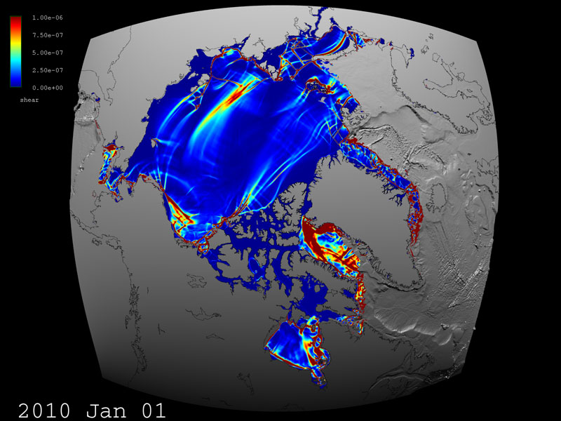
Satellite observations show that during the last decade, sea-ice in the Arctic has become younger, thinner, and weaker, making it more easily deformable by wind and ocean currents. Combining these different observations with a numerical ocean and sea ice model will help scientists to evaluate and improve the ECCO ocean circulation estimates and allow them to better understand what is happening to sea-ice in the Arctic today and to make more accurate predictions of how it may behave in the future. To support these predictions, NAS visualization experts helped to develop a series of custom tools and methods that improve the visibility of cracks and deformations which form as wind blows over sea-ice, and created new high-resolution images and animations for ECCO scientists.
ECCO is one of most computationally complex climate-study projects in the world, and helps scientists learn about the delicate balances between ocean, ice, and atmospheric systems on Earth. Through the use of NASA's high-end computing capabilities and dynamic, evolving computer models, they're able to take a more detailed look at our home planet, which will help understand how these life-supporting planetary systems function, why they are changing, and what that might mean for us.
—Katharine Pitta, NASA Ames Research Center
